AI · Machine Learning · Earth Observation
Reza M. Asiyabi
"I build AI systems that try to understand the world rather than just fit the data."

Who I Am
About Me
I'm a Postdoctoral Research Associate at the University of Edinburgh, building interpretable, physics-aware AI for Earth Observation. Funded by the UK National Centre for Earth Observation (NCEO) and the UKRI SECO project, my current work focuses on domain-aware deep learning for radar–vegetation interactions — teaching AI to interpret forests through backscatter physics rather than pattern-matching alone.
Before Edinburgh, I completed a Marie Curie–funded PhD at the University POLITEHNICA of Bucharest (MENELAOS-NT network), developing complex-valued neural networks for SAR data processing. I then joined Stanford University's Center on Food Security and the Environment to build the Market Activity Index (MAI) — a remote sensing system that detects rural markets in low-income countries from high-resolution satellite imagery.
My research sits at the intersection of theoretical depth and real-world impact: from land-cover analysis and biomass estimation to neural data compression and geospatial multimodal language models. I've published across leading ML and EO venues, won competitive fellowships, and built methods that bridge rigorous physics with practical impact. I thrive in interdisciplinary teams where different domains push each other forward.
Quick Info
What I've Built
Featured Projects
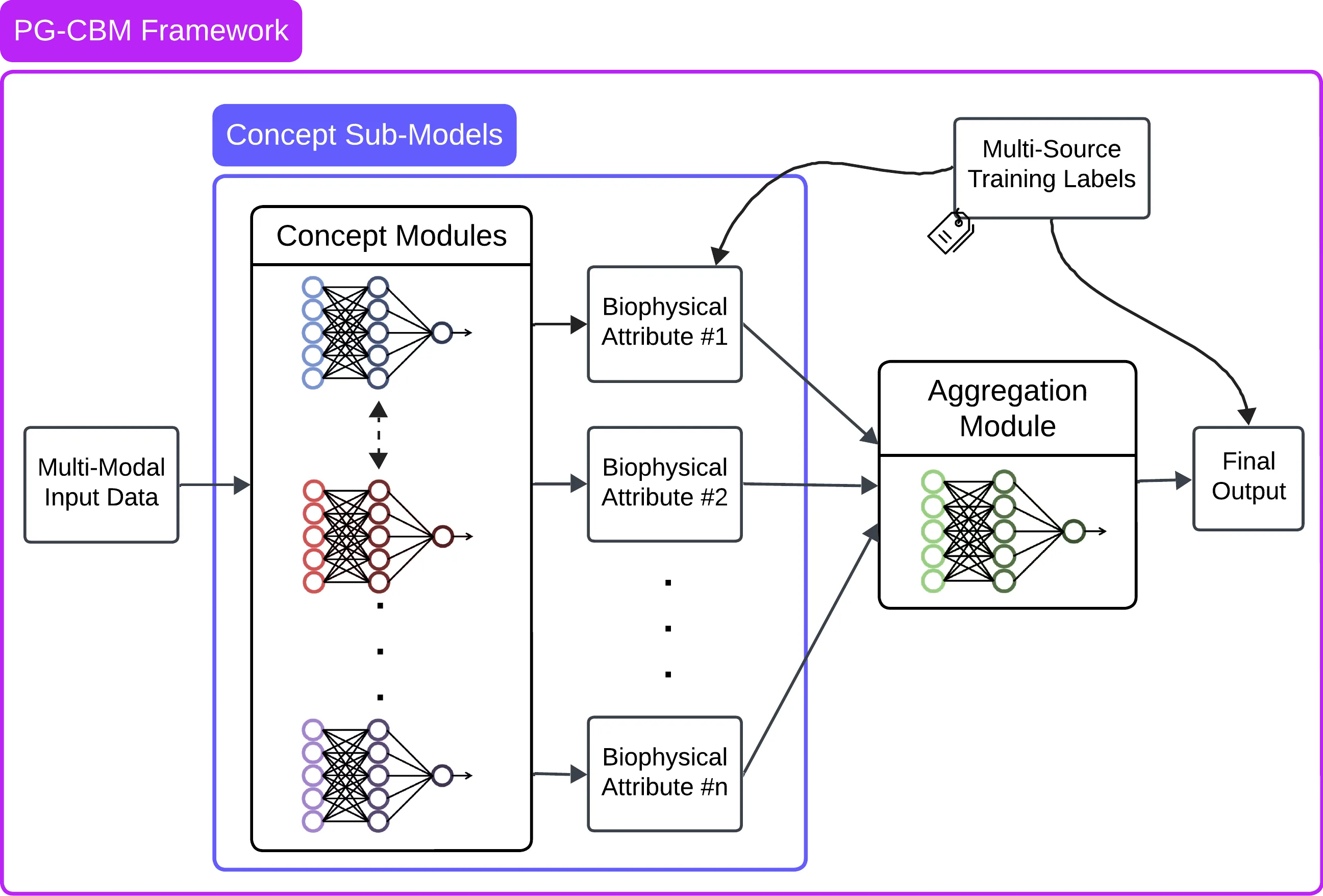
Process-Guided Concept Bottleneck Models (PG-CBM)
Physics-aware interpretable AI that combines domain knowledge with deep learning for biomass estimation from EO data. Models reason about underlying ecological mechanisms, not just statistical patterns.

Market Activity Index (MAI)
Remote sensing system to detect and monitor informal rural markets in low-income countries using high-resolution satellite imagery. Enables real-time economic monitoring where ground data is absent.
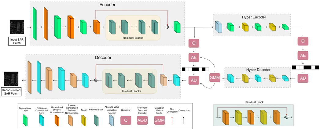
ARTISTE: Complex-Valued Neural Data Compression for SAR data
End-to-end complex-valued autoencoder architecture for compressing SAR raw data, preserving the phase coherency critical for interferometric and polarimetric applications. Published in IEEE J-STSP 2025.
What I Work With
Technical Skills
AI & Machine Learning
Earth Observation
Programming & Tools
Research
Built for Fun & Curiosity
Personal Projects
Side projects and tools I've built outside of work — more on GitHub ↗
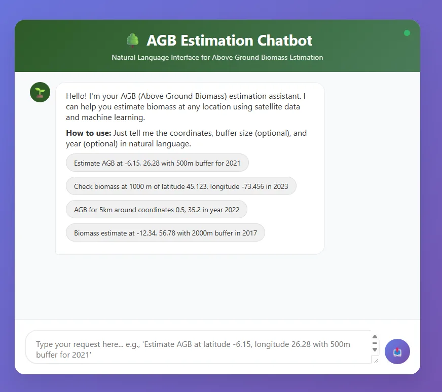
AGB Assistant LLM
A conversational AI chatbot built on top of OpenAI API for answering questions about Above Ground Biomass (AGB).
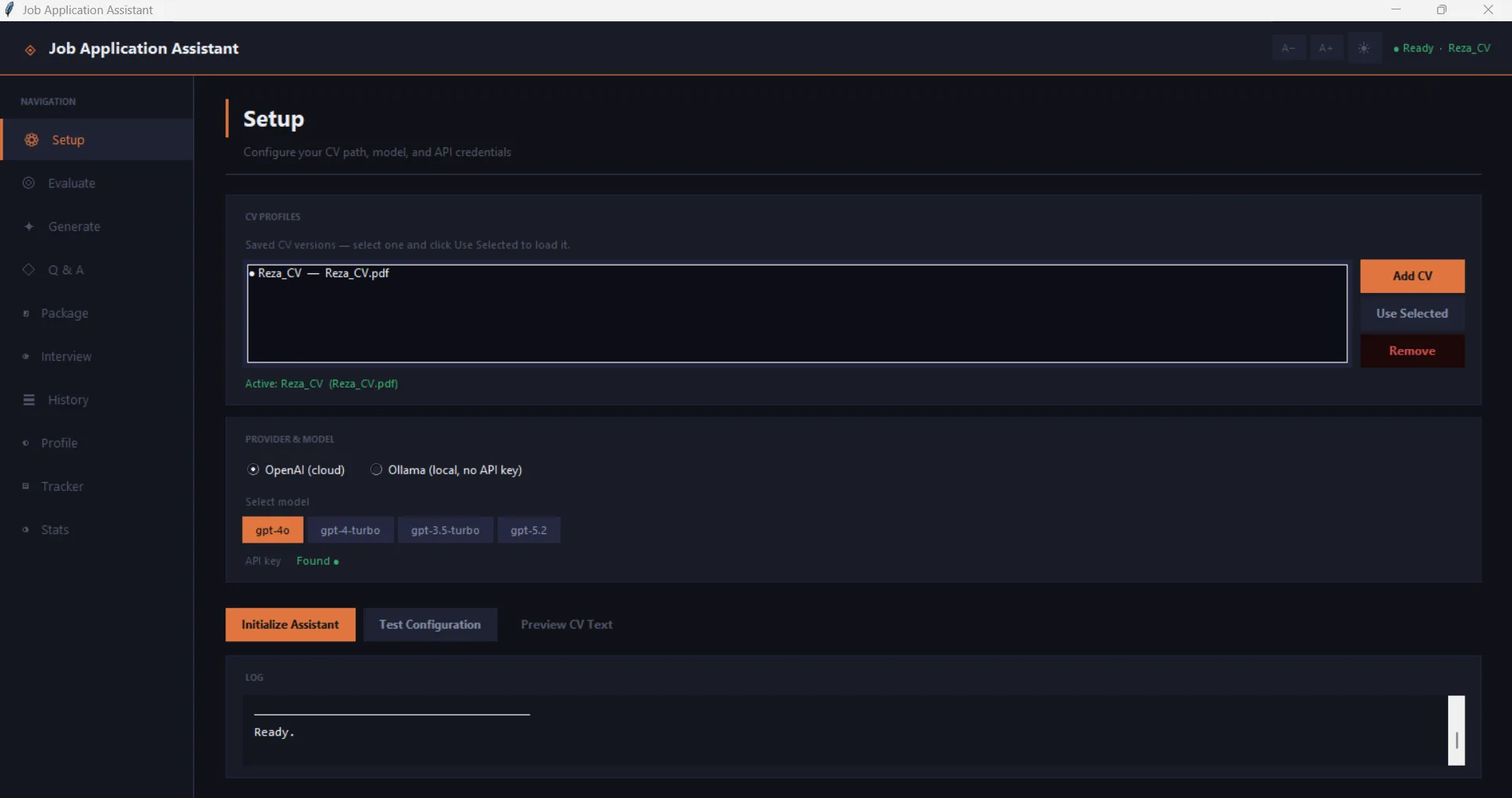
Job Application Assistant LLM
An interactive AI toll built on top of OpenAI API and/or Ollama models as a personal assistant for job applications.

GrAInt
An interactive AI toll built on top of OpenAI API and as a personal assistant for drafting academic grant proposals.
Deep Learning for BioMassters
Multi-architecture benchmark for above-ground biomass (AGB) estimation from satellite time-series. Compares U-Net, 3D U-Net, Swin U-Net, U-TAE, and a custom TempFusionNet on the NeurIPS 2023 BioMassters dataset.
Foundation Model Fine-Tuning
Modular framework for fine-tuning LLMs (LLaMA-2, Mistral) and Vision Transformers (ViT, DINOv2, ResNet) using parameter-efficient techniques including LoRA, adapters, and quantization with distributed training support.
Geospatial Foundation Model for AGB
Fine-tuning geospatial foundation models (Prithvi, DINOv2, ViT) for above-ground biomass estimation using the BioMassters dataset with multi-modal Sentinel-1 + Sentinel-2 temporal sequences. Achieves ~0.82 R².
EuroSAT Land Cover Classification
Land-use/land-cover classification from Sentinel-2 satellite patches using transfer learning. Achieves 98.59% test accuracy with EfficientNet-B0, benchmarking multiple architectures (ResNet, ViT, ConvNeXt, Swin).
Geospatial Foundation Model Benchmark
Modular pipeline for benchmarking geospatial foundation model embeddings (AlphaEarth, Tessera, Sentinel-2 ResNet-50, TorchGeo ViT) across land cover classification, biomass regression, and flood detection tasks.
Where I've Worked
Experience
Postdoctoral Research Associate Current
University of Edinburgh / UK National Centre for Earth Observation (NCEO)
Developing physics-aware and interpretable AI models for biomass estimation from Earth Observation data, focusing on the relationship between radar backscatter and vegetation structure.
- ▸ Developing Process-Guided Concept Bottleneck Models (PG-CBMs) for biomass estimation.
- ▸ Teaching AI models to reason about underlying causal mechanisms rather than statistical mappings.
- ▸ Building domain-aware deep learning pipelines for radar–vegetation interaction analysis.
Postdoctoral Research Assistant
Stanford University / Stockholm School of Economics (Remote)
Contributed to the Market Activity Index (MAI) project at the Center for Food Security and the Environment, building remote sensing approaches to detect local markets in low-income countries.
- ▸ Developed change detection and object detection pipelines for high-resolution EO data.
- ▸ Processed and analyzed commercial satellite imagery to monitor informal economic activity.
AI Researcher
CEOSpaceTech — ARTISTE Project (ESA)
Key personnel on the ESA-funded ARTISTE project, developing AI-based solutions for SAR raw data compression for future ESA satellite missions in collaboration with DLR and Airbus.
- ▸ Developed complex-valued neural data compression methods for SAR raw data.
- ▸ Co-authored the project proposal and contributed to ESA deliverables.
PhD Researcher (Marie Curie Fellow)
University POLITEHNICA of Bucharest / CEOSpaceTech — MENELAOS-NT
Early Stage Researcher in the EU H2020 Marie Skłodowska-Curie Innovative Training Network, developing deep learning solutions for SAR data including the first public complex-valued SAR dataset.
- ▸ Developed complex-valued end-to-end deep architectures for SAR classification and reconstruction.
- ▸ Created the S1SLC-CVDL dataset — the first public complex-valued annotated SAR dataset.
- ▸ Published in IEEE TGRS, J-STARS, J-STSP and presented at IGARSS, EuSAR, CBMI.
Visiting Researcher
Zentrum für Sensorsysteme (ZESS), University of Siegen
Research secondment under MENELAOS-NT, focusing on complex- vs. real-valued architecture comparisons for SAR data classification and presenting results at international venues.
- ▸ Comparative study of complex- and real-valued deep architectures for SAR classification.
- ▸ Presented results at IGARSS 2022, EuSAR 2022, and MENELAOS Forum 2022.
Researcher
Remote Sensing Lab, K.N. Toosi University of Technology
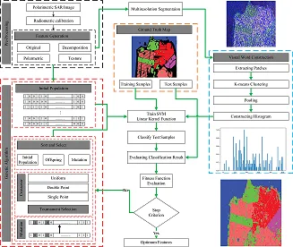
MSc research developing machine learning algorithms for PolSAR data classification, resulting in the Segment-based Bag of Visual Words (Seg-BOVW) method.
- ▸ Developed the Seg-BOVW method for enhanced PolSAR land cover classification.
- ▸ Published results in Advances in Space Research.
Process-Guided Concept Bottleneck Models (PG-CBM)
Reza M. Asiyabi, et al.
Working Paper
Process-Guided Concept Bottleneck Models for Above Ground Biomass Mapping from Earth Observation Data
Reza M. Asiyabi, et al.
Working Paper
Using Satellite Imagery to Monitor Remote Rural Economies at High Frequency
Tillmann von Carnap, Reza M. Asiyabi, Paul Dingus, and Anna Tompsett
Preprint (arXiv)
Complex-Valued Autoencoder-Based Neural Data Compression for SAR Raw Data
Reza M. Asiyabi, Mihai Datcu, Andrei Anghel, Adrian Focsa, Michele Martone, Paola Rizzoli, and Ernesto Imbembo
IEEE J-STSP — Journal of Selected Topics in Signal Processing
Complex-Valued End-to-End Deep Network with Coherency Preservation for Complex-Valued SAR Data Reconstruction and Classification
Reza M. Asiyabi, Mihai Datcu, Andrei Anghel, and Holger Nies
IEEE TGRS — Transactions on Geoscience and Remote Sensing
Synthetic Aperture Radar (SAR) for Ocean: A Review
Reza M. Asiyabi, Arsalan Ghorbanian, et al.
IEEE J-STARS — Journal of Selected Topics in Applied Earth Observations and Remote Sensing
Earth Observation Semantic Data Mining: Latent Dirichlet Allocation-Based Approach
Reza M. Asiyabi and Mihai Datcu
IEEE J-STARS — Journal of Selected Topics in Applied Earth Observations and Remote Sensing
Segment-Based Bag of Visual Words Model for Urban Land Cover Mapping Using Polarimetric SAR Data
Reza M. Asiyabi, Mahmood R. Sahebi, and Arsalan Ghorbanian
Advances in Space Research
Ocean Remote Sensing Techniques and Applications: A Review (Part I and II)
Meisam Amani, Soroosh Mehravar, Reza M. Asiyabi, et al.
Water (MDPI)
Mangrove Ecosystem Mapping Using Sentinel-1 and Sentinel-2 and Random Forest in Google Earth Engine
Arsalan Ghorbanian, Soheil Zaghian, Reza M. Asiyabi, et al.
MDPI Remote Sensing
Generative AI for Earth Observation, a Prospect
Reza M. Asiyabi, Omid Ghozatlou, Saqib Nazir, Mobina Keymasi, Muhammad Amjad Iqbal, Mihai Datcu
MIGARS — International Conference on Machine Intelligence for GeoAnalytics and Remote Sensing
Joint Underwater Depth Estimation and Dehazing from a Single Image Using Attention U-Net
Saqib Nazir, Reza M. Asiyabi, and Olivier Lezoray
DASIP — International Workshop on Design and Architectures for Signal and Image Processing
On the Use of JPEG2000 for SAR Raw Data Compression
Reza M. Asiyabi, Andrei Anghel, Adrian Focsa, Mihai Datcu, Michele Martone, Paola Rizzoli, and Ernesto Imbembo
EUSAR — European Conference on Synthetic Aperture Radar
Complex-Valued Autoencoder for Multi-Polarization SLC SAR Data Compression with Side Information
Reza M. Asiyabi, Andrei Anghel, Paola Rizzoli, Michele Martone, and Mihai Datcu
IGARSS — IEEE International Geoscience and Remote Sensing Symposium
Complex-Valued Autoencoders with Coherence Preservation for SAR
Reza M. Asiyabi, Mihai Datcu, Andrei Anghel, and Holger Nies
EuSAR — European Conference on Synthetic Aperture Radar
Complex-Valued Vs. Real-Valued Convolutional Neural Network for PolSAR Data Classification
Reza M. Asiyabi, Mihai Datcu, Holger Nies, and Andrei Anghel
IGARSS — IEEE International Geoscience and Remote Sensing Symposium
Earth Observation Image Semantics: Latent Dirichlet Allocation Based Information Discovery
Reza M. Asiyabi and Mihai Datcu
IGARSS — IEEE International Geoscience and Remote Sensing Symposium
S1SLC_CVDL: A Complex-Valued Annotated Single Look Complex Sentinel-1 SAR Dataset for Complex-Valued Deep Networks
Reza M. Asiyabi, Mihai Datcu, Andrei Anghel and Holger Nies
IEEE DataPort
Academic Background
Education
PhD in Deep Learning for SAR Data
University POLITEHNICA of Bucharest (UPB)
- • Marie Curie Early Stage Researcher — MENELAOS-NT H2020 ITN Project
- • Research Center for Spatial Information (CEOSpaceTech)
- • Thesis: Deep Learning for SAR Data in Presence of Adversarial Samples
Visiting Researcher
Zentrum für Sensorsysteme (ZESS), University of Siegen
- • Research secondment in the frame of MENELAOS-NT
- • Focus: Complex-valued deep architectures for SAR data classification
MSc in Remote Sensing Engineering
K.N. Toosi University of Technology
- • Remote Sensing Research Center, Faculty of Geomatics
- • Thesis: Bag of Visual Words Model Enhancement for PolSAR Images Classification
BSc in Geodesy and Geomatics Engineering
K.N. Toosi University of Technology
- • Faculty of Geodesy and Geomatics Engineering
Latest Updates
News
Presenting Process-Guided Concept Bottleneck Models (PG-CBM) for above ground biomass estimation at the Data Science for Climate and Environment Workshop. [Data Science Workshop Series]
Attending the NCEO AI strategy workshop and NCEO staff meeting at the University of Reading. [NCEO]
Joined the Generative AI Laboratory (GAIL) at the University of Edinburgh as a fellow. [GAIL]
Presenting work on process-guided AI models for biomass estimation at the EurIPS 2025 conference — AICC Workshop. [EurIPS 2025] [AICC Workshop]
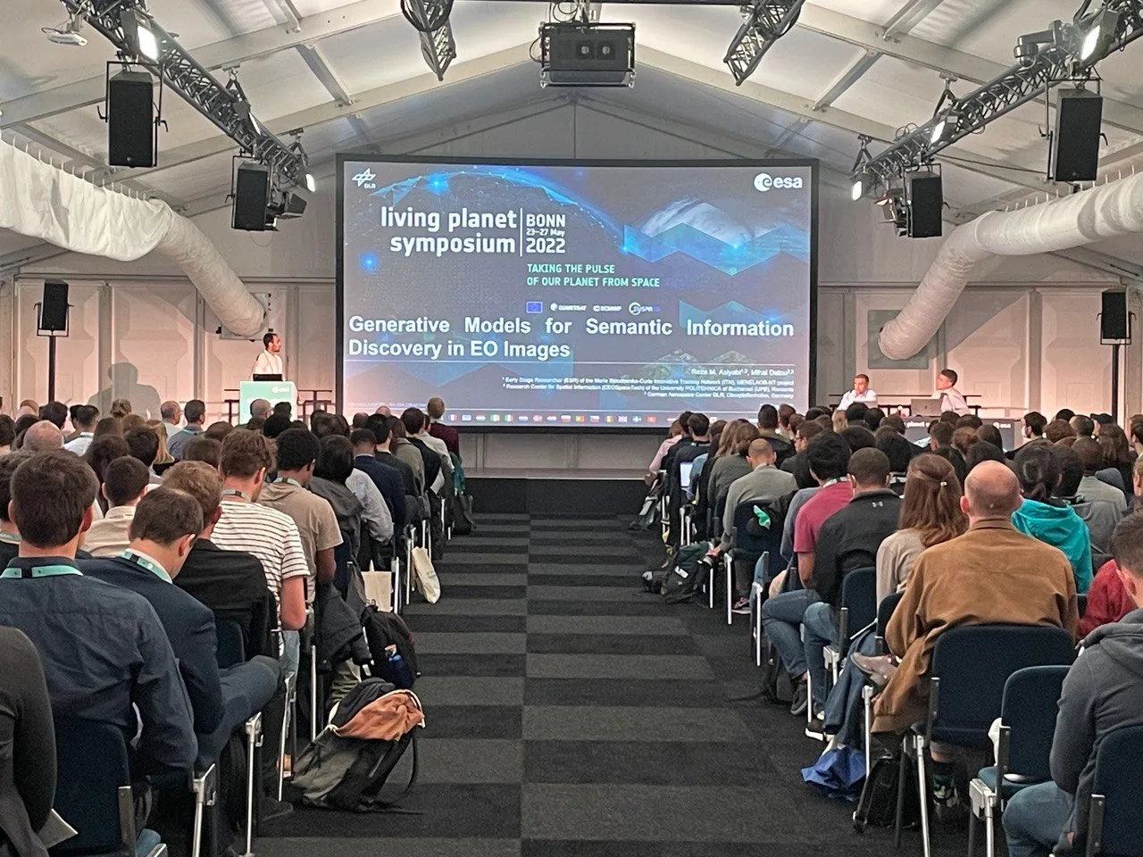
Presenting two talks at the ESA Living Planet Symposium 2025: complex-valued neural SAR data compression, and domain-aware AI for biomass estimation. [LPS 2025]
Life Outside the Lab
Gallery
Travel, sport, and conference moments from around the world.
Get In Touch
Contact
Open to research collaborations, industry opportunities, and interesting conversations. Feel free to reach out.
Want to see beyond the research? Check out my gallery ↗